 Ketchikan City Guide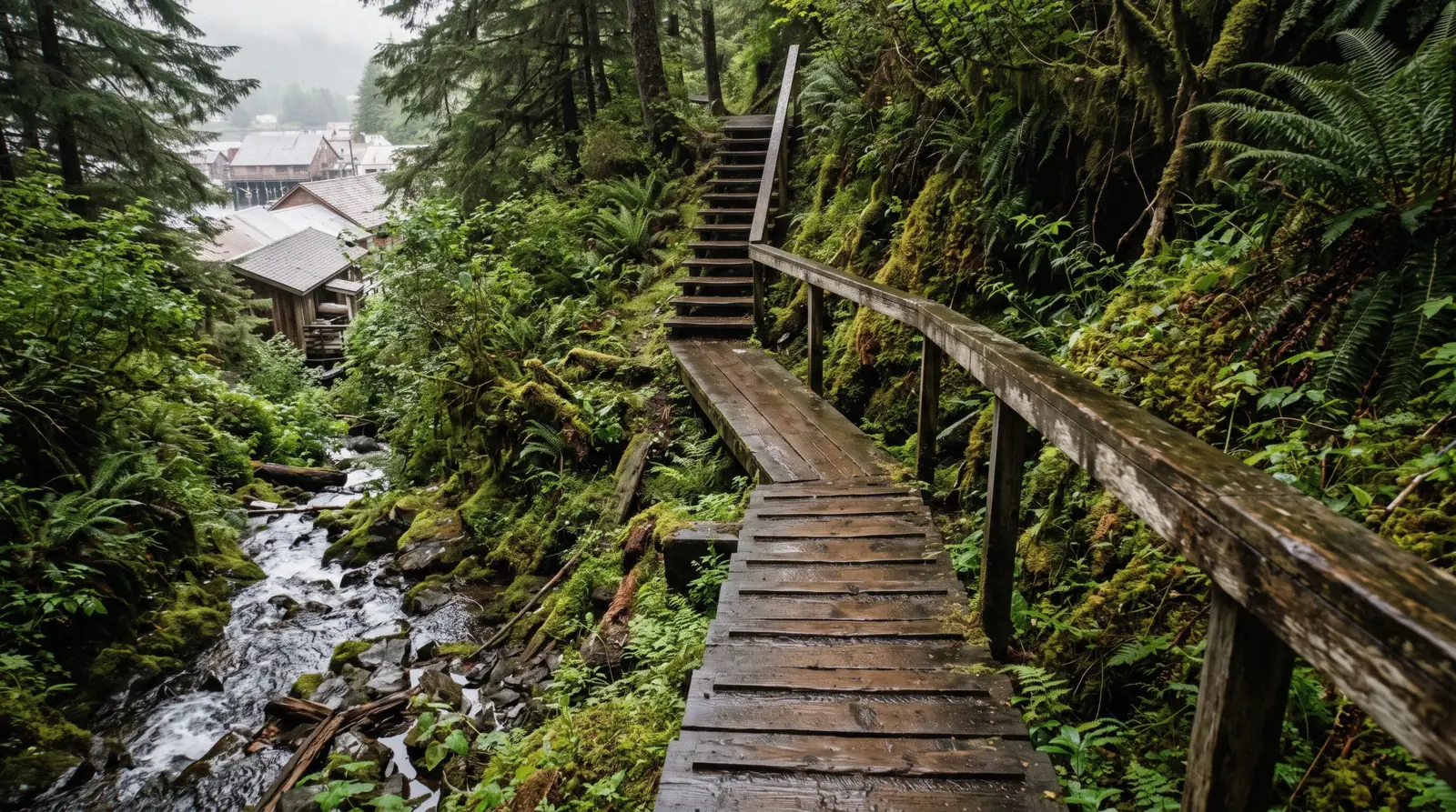
Married Man's Trail, Ketchikan
Married Man's Trail Ketchikan is a public stair route up beside the creek, and no official page describes it at all. married Man's Trail is a short stair climb at the top end of Creek Street in downtown Ketchikan. Secondary sources put it at roughly 0.20 miles one way with about 100 feet of elevation gain, mostly on stairs and boardwalk. No official City of Ketchikan or Forest Service page describes the trail at all, so the details on this page are secondary. The name comes from a story, repeated by tourism sites, that the route once gave men discreet access to Creek Street's red-light district. It is free, it takes minutes, and it connects the boardwalk to the forest above the creek. Pair it with a walk along Creek Street. The town all of this sits in is the Ketchikan guide at the foot of the stairs.
Quick answer Short free stair trail above Creek Street, described only by secondary sources
Married Man's Trail is a very short stair route at the upper end of Creek Street in downtown Ketchikan. Secondary sources describe it as roughly 0.20 miles one way with about 100 feet of gain on stairs and boardwalk, following Ketchikan Creek upstream past the fish ladder. It is a public trail, so there is no fee and no ticket booth. No official City of Ketchikan or US Forest Service page publishes its length, surface or accessibility, so treat all figures here as secondary. The repeated story that it gave discreet access to Creek Street's brothels is folklore, not documented history. It sits steps from the [Creek Street](/creek-street/ boardwalk), near the base of the Deer Mountain side of town.
Key takeaways
- The trail is free and takes only minutes, making it an easy add-on to a walk along Creek Street.
- Secondary sources give about 0.20 miles one way and 100 feet of gain, while no official source publishes any trail details, so plan the rest of your day around the one day in Ketchikan basics.
- It is stairs and boardwalk, not a step-free path, so check the accessibility guidance if stairs are a problem.
- If you want a longer walk in the same direction of travel, the full Deer Mountain trail starts further out of town.
Key facts
Opening hours
| Daily, all year, daylight |
|---|
Planning it
- Time needed
- Not stated by anyone. Our routing: 20 minutes up
- Book ahead
- Optional — walk-up usually fine
- Address
- Between Creek Street and Deermount Street, Ketchikan. The coordinate above is the foot of the stairs, since no registry publishes one for the route
There is nothing to buy here, which is the point of the page. The official row is the City of Ketchikan, which owns the ground and publishes nothing about the route at all. The tour rows are the guided walks people book when they want somebody to explain what they are looking at.
It is the shortest way from the boardwalk to the museum on the hill, and it is stairs the whole way.
| Option | Price | Includes | Cancel | Book |
|---|---|---|---|---|
| Walk it yourselfAnyone who can manage stairs. It costs nothing and needs nothing. | Free | A stair and plank route up beside the creek | Nothing to cancel | Official site |
| Ketchikan Photo SafariAnyone who wants the creek and the boardwalk photographed properly. | From $135 | Three hours, small group, pickup available | Free up to 24 hours before | Check Availability |
| E-Bike and Hike TourAnyone who wants a guided walk with more ground covered. | From $164 | Four hours, e-bike and hike with pickup | See the operator listing | Check Availability |
No city or Forest Service page describes this trail. Secondary sources give roughly 0.20 miles one way and about 100 feet of gain, and repeat a story about discreet access to Creek Street. We print the figures as secondary and the story as a story.
Guided walks that take the same hill
Four listings that cover the creek and the town on foot or by bike. Prices, ratings and durations are the platform’s own figures.
 from $135
Small group
from $135
Small group Ketchikan Photo Safari
A local photographer guides small groups through Creek Street, Ketchikan Creek and Potlatch Totem Park, teaching composition and framing along the way. Suited to travelers who want photo coaching built into their sightseeing rather than a straight wildlife or cultural tour.
Check Availability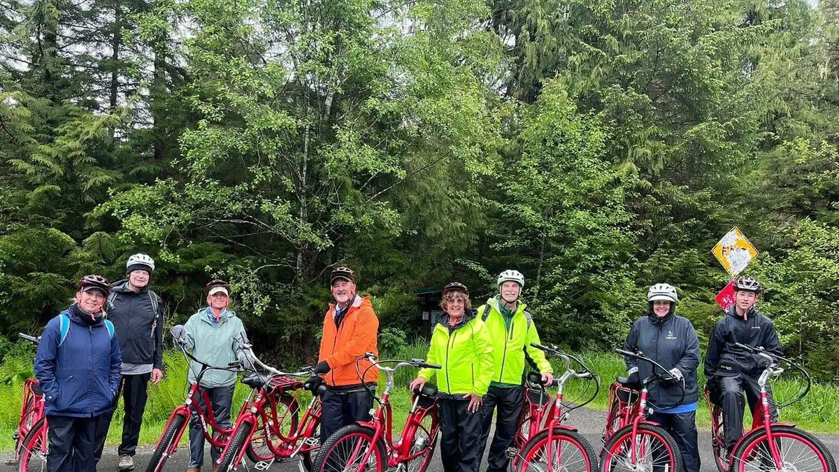 from $164
Pickup available
from $164
Pickup available Ketchikan: E-Bike and Hike Tour
Riders pedal e-bikes eleven miles to the edge of the road system, then hike into the Tongass National Forest to a waterfall. The day ends with smoked salmon at the marina, a fit for visitors wanting light exercise over a bus tour.
Check Availability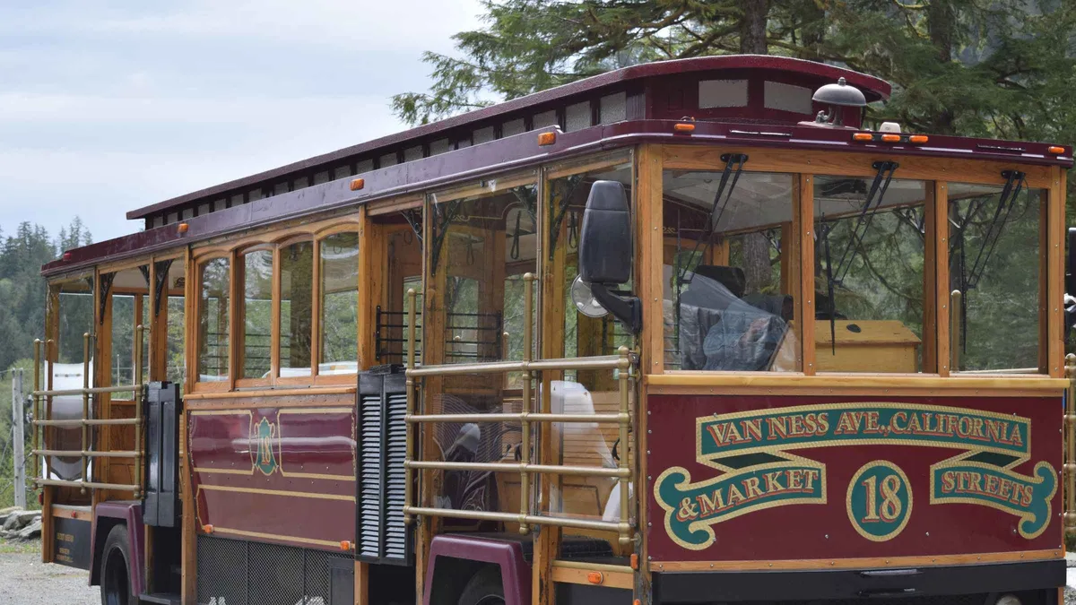 from $85
Free cancellation
from $85
Free cancellation Ketchikan: Totem Pole, Wildlife & City Trolley Tour
An open-sided San Francisco style trolley tours Saxman Native Village's carved totem poles and carving shed, then continues to Herring Cove for a chance at eagles, seals and bears. A shorter option for travelers who mainly want the totem poles and a quick wildlife stop.
Check Availability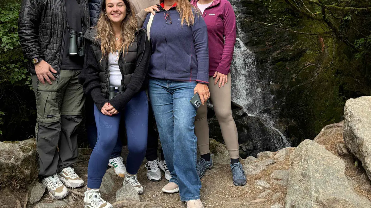 from $84
Free cancellation
from $84
Free cancellation Ketchikan: Alaska Native Cultural and Scenic Shore Excursion
A Native-guided van tour run by Clan House Tours stops at four wildlife viewpoints and Totem Bight State Historical Park to cover Haida, Tlingit and Tsimshian history and craft. Fits travelers who want cultural context alongside a chance at spotting bears, salmon and eagles.
Check AvailabilityPrices, ratings and details are the platform's own. dollar figures are the listed prices — the platform bills in your account's currency.
What Married Man's Trail is
Married Man's Trail is a staircase, and that is the whole point. Almost every other place in this guide is a museum, a park, a tour or a boat trip. This is a public footpath of stairs and boardwalk that climbs from the top end of Creek Street up the slope beside Ketchikan Creek. It exists to move people between the boardwalk and the streets above, quickly, and it has apparently been doing that for a long time.
The practical facts are thin. Secondary sources such as Tripadvisor, Wanderlog and Yelp describe it as roughly 0.20 miles one way, about 100 feet of elevation gain, on stairs and boardwalk. No official City of Ketchikan page and no US Forest Service page describes the trail at all. There is no published length, surface specification or accessibility statement from any government source, and that gap is the most important thing to know about it.
The name carries a story that gets repeated everywhere: the trail supposedly gave men discreet back-door access to Creek Street when it was a red-light district, and doubled as an escape route during police raids. It is a good story. It is also not documented history. No official city document, historical society page or primary source confirms it with a date, so treat it as local folklore until somebody produces a record.
What you get is simple. It is free, because it is a public trail. It is short, so it costs minutes rather than an hour. And it is stairs, which means it is not a route for anyone who cannot manage a climb. It is the kind of thing you do because you are already standing at the top of Creek Street looking at the stairs and wondering where they go.
What you see on the way up
You start at the northeast end of Creek Street, where the boardwalk stops being shops and restaurants and becomes quiet pilings over running water. Secondary sources describe the trail as following Ketchikan Creek upstream from here, past the fish ladder, before turning up the slope.
The creek itself is the first thing worth stopping for. The Alaska Department of Fish and Game describes Chinook (king) and coho (silver) salmon as the species viewable in Ketchikan Creek, with spawning fish filling the creek each July and August and the best viewing window running May through September, peaking July-August. Viewing is from bridges and banks over the creek, and the Forest Service runs a live underwater camera in the same water, which tells you how good the viewing gets at peak.
Then come the stairs. The trail is described by secondary sources as mostly stairs and boardwalk, climbing roughly 100 feet over its short length. You are walking up through the damp green edge of the Tongass rainforest at the edge of downtown: moss, ferns, the sound of the creek below, the roofs of Creek Street buildings appearing and disappearing through the trees as you gain height. Nobody publishes a plant list or an interpretive sign inventory for this trail, because nobody official publishes anything about it.
At the top you come out on the street grid above the waterfront, the ordinary residential side of Ketchikan that most cruise visitors never walk through. From there you can look back down toward the harbor and the ship berths, or loop back down another street to the boardwalk. The whole thing is a five-to-fifteen-minute experience unless you stop to watch the fish, in which case it is a twenty-minute one.
Honest caveat: descriptions of what the trail looks like come from visitor reviews and tourism sites, not from an official trail guide, because no official trail guide exists.
Hours and cost
The cost is the easiest part. Married Man's Trail is a public trail with no gate, no booth and no fee. Free public trails sit alongside Creek Street's free boardwalk and the free underwater salmon camera at the Discovery Center in the off-season as the confirmed no-cost things downtown.
The hours are the opposite of easy. Nobody publishes any. There is no official City of Ketchikan page and no Forest Service page describing this trail, so there is no published opening season, no closed days and no hours-of-darkness guidance. As a public stairway it is physically open whenever you choose to walk it, but the responsible statement is: hours not stated, by anyone, anywhere official.
The same gap applies to safety and maintenance. No agency publishes a maintenance schedule, a lighting statement or a winter-closure notice for this trail. What you should do instead is simple. Walk it in daylight, because stairs in Southeast Alaska rain are slick enough at noon. Check current conditions at the Ketchikan Visitors Bureau Welcome Center at 131 Front St, open Monday-Friday 8am-5pm and closed weekends, or phone (907) 225-6166, where staff can tell you whether locals currently consider it in walkable shape.
For context on what nearby managed attractions do publish: the Totem Heritage Center posts hours of 8am-5pm daily May-September and 1pm-5pm Monday-Friday October-April, and the Southeast Alaska Discovery Center charges $5 per person May-September with free entry October-April. Married Man's Trail asks for none of that planning. It costs nothing, it asks nothing, and the price of that is that no official body takes responsibility for telling you anything else about it.
Trail figures on this page are secondary-source descriptions
Getting there
This is one of the few attractions in Ketchikan where the answer for cruise passengers is simply: on foot. The trail starts at the northeast end of Creek Street, and Creek Street is downtown.
From the downtown cruise berths, you walk. The Port of Ketchikan lists four Panamax berths, numbered I to IV south to north along the downtown waterfront, and the official port page does not state a walking time to Creek Street. In practice this is a central-downtown walk through the historic district, following the waterfront to the Creek Street entrance and then walking the boardwalk to its top end. If you are at Ward Cove instead, take the complimentary shuttle to Berth IV first, it runs about 20 minutes each way and starts when your ship arrives.
The $2.00 borough bus exists, and the adult single ride is $2.00 with a $5.00 day pass available, but it is pointless for this trail. The downtown Free Downtown Shuttle Zone, running from Bryant Street to the Coast Guard Base, is fare-free anyway, and the trailhead sits inside walking distance of it. No bus route replaces a short stroll.
A booked tour is even more pointless here. The trail is free, unguided and unlisted on any official page, so no commercial tour product is built around it. If you want a guided experience in the same creek-and-forest vein, the Ketchikan Photo Safari is a 3-hour van-and-walking tour, and the Alaska Rainforest Sanctuary walks take you into managed rainforest at Herring Cove.
So the honest routing: walk from your berth, find Creek Street, walk the boardwalk to the top, and the stairs are there.
One line from the source, verbatim, because it is the detail nobody else prints: Not stated (secondary sources describe stairs and boardwalk sections, not step-free)
Married Man’s Trail map: between the boardwalk and the museum
No open registry publishes a coordinate for this route, so the pins below are the boardwalk at the bottom and the museum at the top.
Do and don't on Married Man's Trail
Five minutes of judgment makes this a good stop instead of a wet mistake.
Do
- Walk the whole Creek Street boardwalk first so you reach the trailhead at its top end.
- Time your climb for July or August if you want spawning salmon in the creek below the stairs, per the salmon viewing calendar.
- Go in daylight and dry-footed shoes, and check conditions at the Welcome Center listed on the cruise port page.
- If stairs are hard for you, swap this for the flat boardwalk and the indoor stops on the accessibility page instead.
Don't
- Do not buy a tour to reach it, no tour serves a free public staircase steps from downtown.
- Do not repeat the brothel-back-door story as fact, it is folklore that no official source documents.
- Do not attempt it in the dark or in heavy rain, no agency publishes lighting or winter conditions for it.
- Do not confuse it with the Deer Mountain trail system, which is a 10.7-mile climb, not a stairway.
How long to give it
Short ship call: fifteen minutes, total. Walk Creek Street, climb the stairs, look back at the water, come down. If your ship is only in port for a half day, this fits alongside Dolly's House Museum on the boardwalk and a look at the salmon from the bridges. It skips the museums and every out-of-town attraction, which is the right call on a short call.
Full day: fold the trail into a downtown morning and give the whole cluster two to three hours. Walk the boardwalk, climb the trail, watch the creek, then add the Totem Heritage Center at 601 Deermount St, open 8am-5pm daily May-September, and the Southeast Alaska Discovery Center at 50 Main St, open 9am-5pm daily in season with a $5 entrance fee May-September. This routing buys you the entire creek-and-totem story on foot and skips anything requiring a bus or a boat. If you then have hours left, that is when a longer hike such as the Deer Mountain trail, a 10.7-mile route with about 2,000 feet of gain in the first two miles, becomes a separate commitment for another day.
Second visit: use the trail as a warm-up rather than a destination. You already know Creek Street. Climb the stairs once for the view, then put your time into things a first visit skips, like a floatplane trip into Misty Fjords National Monument, which covers 2,142,243 acres reachable only by boat or floatplane, or a bear-viewing run to Neets Bay.
The pattern holds across all three: the trail is a connector, not an anchor. Give it minutes and give your hours to something bigger.
Five things most visitors do not know
- No official page for the trail exists at all. Neither the City of Ketchikan nor the US Forest Service publishes its length, surface or accessibility, so every number you read about it is secondary. (nobody publishes this) - The 0.20-mile and 100-foot figures come from visitor review and tourism sites like Tripadvisor, Wanderlog and Yelp, not from any government source.
(Tripadvisor and other secondary sources) - The brothel-access and police-raid story behind the name is repeated by many tourism sites but is not confirmed by any official document with a date, so it is folklore rather than documented history. (nobody publishes this) - The trail passes the fish ladder on Ketchikan Creek, and the creek's confirmed viewing species are Chinook and coho salmon, with peak viewing in July and August. (Alaska Department of Fish and Game) - The trail is one of very few downtown activities with no cost at all, alongside the free Creek Street boardwalk and the Discovery Center's underwater salmon camera, which is free October through April.
(US Forest Service)
Next
Accessibility
This route has no step-free alternative published: accessibility in Ketchikan.
Read before you climbMarried Man's Trail questions
Is Married Man's Trail in Ketchikan free?
Yes. It is a public trail with no gate, booth or fee, matching other no-cost downtown options like the Creek Street boardwalk. Strictly, the free status comes from secondary sources since no official page governs the trail, but nothing on site collects money. The same is true of walking the boardwalk itself, where fees apply only to specific attractions along it such as Dolly's House Museum. Budget nothing for the trail, and see the Ketchikan costs page for the rest of your day.
How long and how steep is Married Man's Trail?
Secondary sources describe it as roughly 0.20 miles one way with about 100 feet of elevation gain, mostly on stairs and boardwalk. Treat those figures as approximate, because no official City of Ketchikan or Forest Service page describes the trail at all and publishes no length, surface or accessibility data. The practical takeaway is short and steep: minutes of climbing rather than a hike. If you want a real hike with published figures, the Deer Mountain trail is 10.7 miles with about 2,000 feet of gain in the first two miles.
Where does Married Man's Trail start?
Secondary sources place the trailhead at the northeast end of Creek Street, following Ketchikan Creek upstream past the fish ladder. Creek Street is downtown, a short walk from the cruise berths along the waterfront, though the official Port of Ketchikan page states no walking time to Creek Street. If you dock at Ward Cove, take the free shuttle to Berth IV first, about 20 minutes each way. See the Ketchikan map page and the getting around page for orientation.
Is Married Man's Trail worth doing?
Worth doing, not worth planning a day around. It costs nothing, takes minutes, and climbs through rainforest at the edge of downtown to a view most cruise visitors never see. Its real value is as a connector: you walk Creek Street, climb the stairs, and come out on the residential streets above with a feel for the town beyond the boardwalk. If your time is tight, prioritize the Totem Heritage Center or the Discovery Center and treat the stairs as a bonus on the way past.
Can you see salmon from Married Man's Trail?
Yes, in season. The trail follows Ketchikan Creek past the fish ladder, and the Alaska Department of Fish and Game identifies Chinook and coho salmon as the species viewable in the creek, with spawning fish filling it each July and August and the general viewing window running May through September. There is no formal fish ladder viewing platform described by ADFG, so you watch from the banks and bridges, and the Forest Service runs a live underwater camera in the same creek. Pair the climb with the stops on the things to do list.
Is Married Man's Trail open in rain and winter?
No agency publishes hours, seasons or closures for the trail, because no agency publishes anything about it. Rain is the bigger practical issue than season: Ketchikan's normal precipitation is 149.54 inches a year spread over about 232.6 days, so wet stairs are the default condition and good footwear matters. Walk it in daylight only. If you need certainty about conditions, ask staff at the Visitors Bureau Welcome Center or plan around indoor options on the Ketchikan weather page.
Married Man's Trail on video
Three films that show this place at real pace, which is the check on every time figure above.
What to Do in Ketchikan Alaska on a Cruise Port Day
Walks the creek and the stairs behind the boardwalk.
Video: Take2Travel11 Amazing Things You MUST Do in Ketchikan, Alaska
Shows the climb up from the boardwalk.
Video: Art We There Yet?Ketchikan, Alaska Cruise Port Guide
The route from the berths to the creek.
Video: The Port LowdownLinked as published on YouTube. We have no connection to these channels.
We may earn a commission if you book through one of our links, at no extra cost to you. Full affiliate disclosure